Day 10
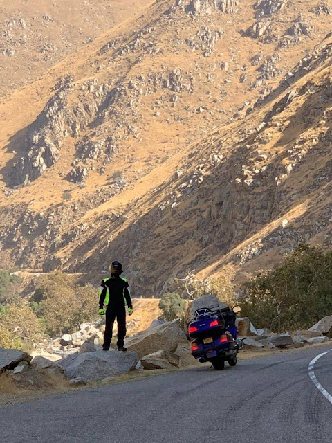
Today was supposed to be a down day for the 2018 Prefrontal Tour, in that we would make no forward progress. And while that's true in the cartographic sense, we still managed to move the needle more than any other day of the Tour so far. We spent the morning taking care of incidental issues about town, checking over the bikes, buying souvenirs, and picking up a few clothing items that were more appropriate for this 80-plus degree weather. We're having a lot of navigational snafus in this town, especially related to lane changes, so getting to lunch was a bit of an affair, but with that out of the way we took off for a 185-mile long loop through the Sequoia National Forest. The line on the map looked twisty, but it didn't do justice to the real thing - thousands of turns, twists, and blind hills carved into the side of the mountains with no guard rails, a precipitous drop at the edge of the tarmac, and random cows walking in the road thousands of feet up and tens of miles from nowhere. It was a veritable amusement park for motorcycles. Mountains towering overhead, a Coors-esque river below, and the strongest smell of pine you can imagine. A fighter jet went screaming overhead, turning hard to stay within the canyon walls, and I thought that might be the only mechanical thing more fun than what we were doing. You have to take your A game on those roads, and it was impossible to enjoy the scenery and keep the shiny side up, so we stopped as often as we could for photos and rehydration in the dry mountain air. With all that dry pine, those mountains would go up like kerosene if they ever caught fire, which from the look of things they do. In fact it's so dry that when we rode past Lake Isabella we thought we could see the marinas in town were about a quarter mile from the edge of the water! The sequoias themselves were as cool as you read about, and most had charring on their trunks that went straight through to the wood. On the return half of the loop we drove down Route 68 past hundreds of orchards and vineyards - what looks like a million miles of planted rows on one side of the road with desert on the other - maybe not the best place to grow things water-wise? Every once in a while we'd pass their bee hives and immediately notice them whizzing overhead. I took a few in the shins and wondered how many a day are lost to vehicles on that busy highway. At one point I noticed a couple of oil wells pumping right inside an orange grove, and that put some truth to the advice to wash your fruit when you buy it - and all of a sudden we were in the middle of thousands of bobbing oil wells in an ugly industrial zone. Big ones, little ones, skinny ones, fat ones. Even a tiny one fashioned into a mailbox. It was like seeing a herd of natural animals and the variation within a species one would expect. It lasted for about 5 miles, then just as quickly we were back into the orchards and vineyards as if our regularly scheduled programming had resumed. In the final stages of the return we got a better look at the miasma that overhangs Bakersfield - a thick, dense blanket that blocks the view and that has a very definite ceiling that's visible when you're descending into the valley. South Park would have us believe it's a cloud of "smug" from all the Prius drivers in LA, but sadly Bakersfield was labeled the worst city in America for air quality a few years ago, taking the mantle from LA all by itself. Surrounded by mountains on all sides, the bowl of Bakersfield fills with pollution, and makes you wonder why they'd choose to grow so much food here. All in all it was the best day yet in terms of entertainment and adventure, and we're looking forward to visiting the Pacific tomorrow and then turning east. We've had a number of route entries, and based on weather and points of interest we're leaning toward I-40 back to Flagstaff then 160 north and east through Colorado. We're still open to suggestions and we appreciate all the help we can get predicting weather and road conditions! Onward and upward.


